
The all-in-one boating app for NSW
The smarter way to explore the waterways of New South Wales
Trusted by over 1 million users, DECKEE brings everything NSW boaters and anglers need into one reliable app.
From maps and live marine forecasts to official safety information from government agencies, DECKEE helps you stay safe, informed, and confident every time you set out to have fun on the water.
Features of New South Wales #1 Boating App - DECKEE
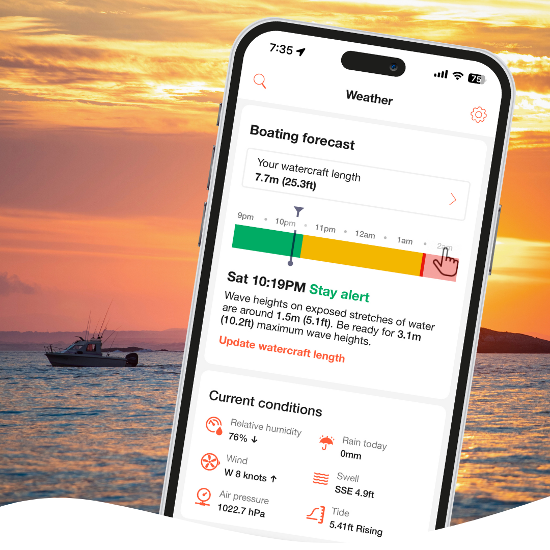
Personalised NSW boating forecast
Check real-time forecasts, tide predictions, and wind conditions tailored to your location.
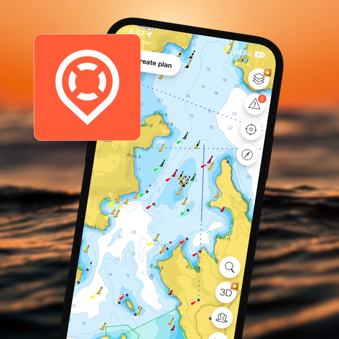
Explore local maps and depth charts
Interactive maps with boat ramps, marinas, fishing spots, and safety zones across all states.
Safety and preparation
NSW boating equipment checklists, BOM weather warnings, float plans, and reminders to keep you and your passengers safe.
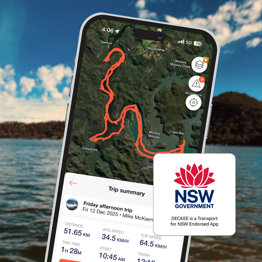
Automatic logbook
Track your activities on the water without lifting a finger, thanks to DECKEE’s on-water detection capability.
Location sharing and float plan
Share your live GPS position or a float plan with friends or family for peace of mind.
DECKEE is a Transport for NSW Endorsed App
DECKEE works alongside maritime agencies and water safety partners nationwide. When you open DECKEE, you’re viewing verified information directly from the same teams who manage and protect our waterways. Our partners include:
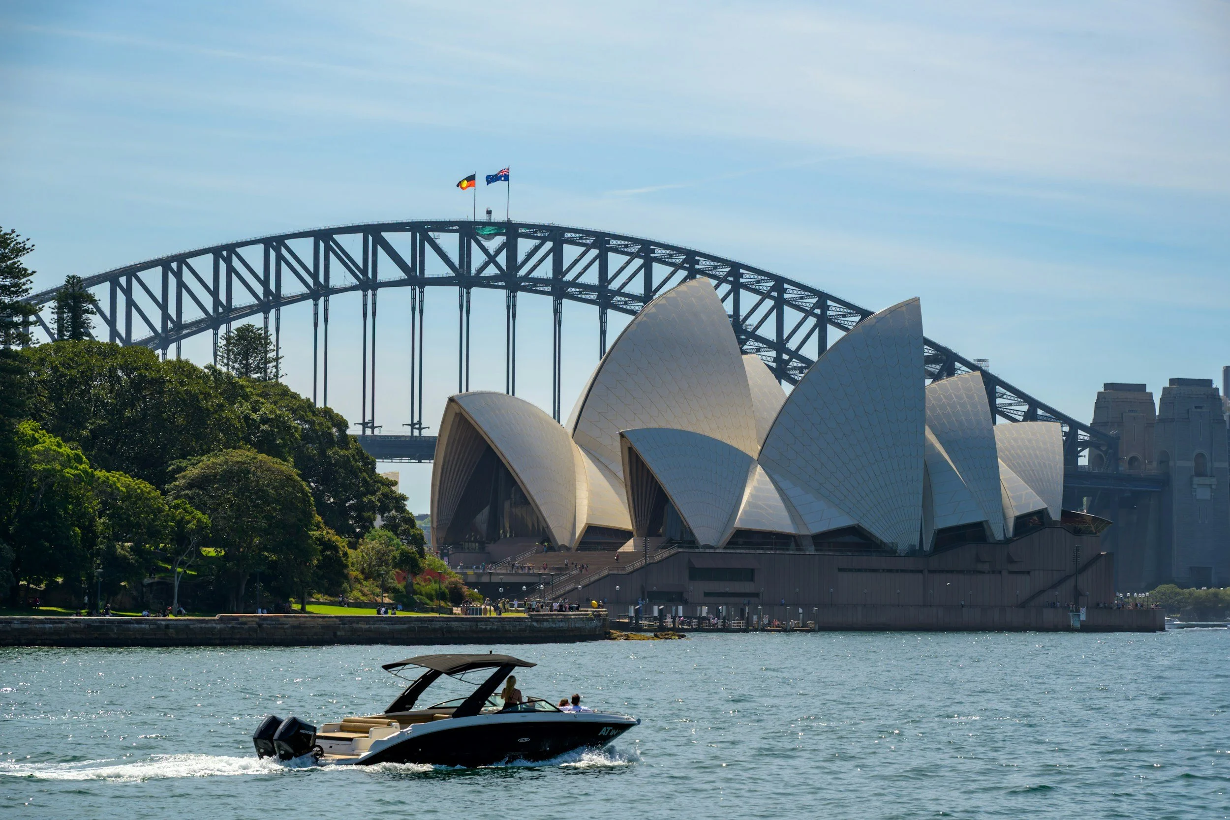
Boating and fishing in New South Wales with the DECKEE app
From Coffs Harbour to Eden and everywhere in between, DECKEE has you covered in NSW
New South Wales offers some of Australia’s most diverse boating and fishing waters. From busy metropolitan harbours to quiet estuaries, offshore reefs, rivers, and inland lakes, DECKEE helps NSW boaters plan every trip with confidence.
DECKEE brings together local marine maps, weather forecasts, tides, and official safety information specific to New South Wales all in one easy-to-use app.
Explore New South Wales waterways with confidence
From world-famous destinations to local favourites, DECKEE supports boating across NSW coastal and inland waters.
Explore Sydney Harbour, Pittwater, Broken Bay, Port Hacking, and Botany Bay
Plan trips on the Hawkesbury–Nepean River system and Lake Macquarie
Discover estuaries, lakes, and offshore grounds from the Central Coast to the South Coast
Plan smarter before you head out
DECKEE helps NSW boaters prepare with local, practical information:
Check weather, wind, swell, and marine forecasts for NSW waters
View local tides, depth contours, and navigation features
Find boat ramps, marinas, anchorages, and on-water facilities
Identify speed zones and local boating areas
Discover fishing spots and nearby points of interest
DECKEE is a Transport for NSW Endorsed App
Stay informed with official, location-specific information:
Updates and alerts from Transport for NSW
Navigation warnings and local safety notices
Information to support safer boating decisions on NSW waterways
Remember to log on and log off with Marine Rescue NSW
DECKEE encourages all boaters in New South Wales to log on and log off with Marine Rescue NSW before and after every trip. Logging on ensures Marine Rescue NSW has your trip details and can respond more quickly if you don’t return as planned or need assistance on the water.
At this time, it is not yet possible to log on or log off with Marine Rescue NSW directly through the DECKEE app in New South Wales. Boaters should continue to log on and log off using Marine Rescue NSW’s existing channels, including radio, phone, or the Marine Rescue NSW app, before heading out and once safely back.
Made for all kinds of water explorers in NSW
DECKEE supports every type of boater and water user:
Recreational boaters: Stay compliant and confident with verified rules in Australia
Fishers and divers: Use depth and contour maps to find hidden spots
Jet ski and PWC riders: Check speed-restricted zones before you launch
Kayakers and paddlers: Track your route automatically and share your live location
No matter how you enjoy the water, DECKEE helps you do it safely in New South Wales.
Frequently Asked Questions
-
DECKEE is a Transport for NSW endorsed app, designed for anyone who loves to boat, fish, sail or paddle. The app combines maps, weather, and official safety guidance into one easy tool, designed specifically for NSW boaters, anglers and paddlers.
-
Yes, depth charts for all coastal waters in New South Wales are available as part of the optional DECKEE Supporters Club membership.
-
Government agencies across Australia work closely with DECKEE to share official boating safety information, local regulations, and real-time alerts. Many maritime authorities use DECKEE as an official communication partner to help boaters access accurate data directly from trusted sources. This collaboration ensures the information shown in the app, such as speed zones, safety requirements, and marine advisories, is verified, up to date, and consistent with government standards.
-
Unlike navigation-focused tools, DECKEE is built for planning, safety, and preparation, helping you decide where to go, when to go, and what to do.