
Australia’s all-in-one boating app

The smarter way to explore and enjoy Australia’s waterways
Trusted by over 1 million users, DECKEE brings everything Australian boaters need into one reliable assistant app.
From maps and live marine forecasts to official safety information from government agencies, DECKEE helps you stay safe, informed, and confident every time you set out to have fun on the water.
Features of Australia’s favourite boating app - DECKEE
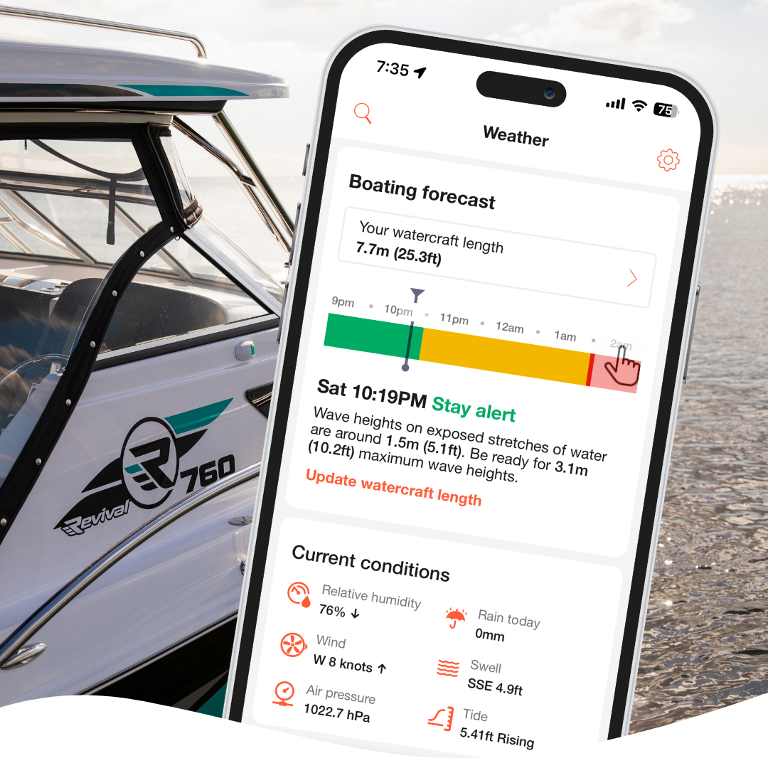
Personalised boating forecast
Check real-time forecasts, tide predictions, and wind conditions tailored to your location.
Explore maps and depth charts
Interactive maps with boat ramps, marinas, fishing spots, and safety zones across all states.
Safety and preparation
Boating equipment checklists, BOM weather warnings, float plans, and reminders to keep you and your passengers safe.
Automatic logbook
Track your activities on the water without lifting a finger, thanks to DECKEE’s on-water detection capability.
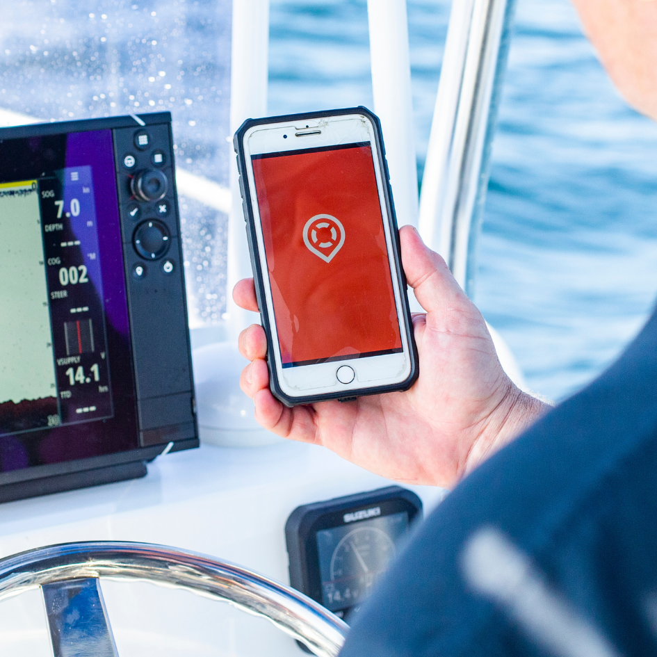
Location sharing and float plan
Share your live GPS position or a float plan with friends or family for peace of mind.
Recommended by government agencies
DECKEE works alongside Australian maritime agencies and water safety partners nationwide. When you open DECKEE, you’re viewing verified information directly from the same teams who manage and protect our waterways. Our partners include:
Boating and fishing in Australia with the DECKEE app
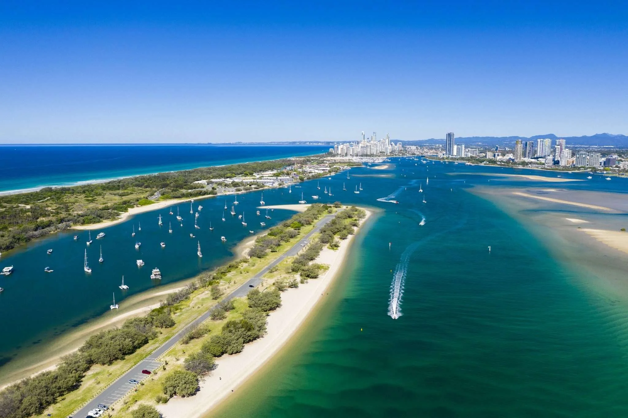
From harbours to reefs, rivers, and lakes, DECKEE has you covered
Australia’s boating community spans every coast and waterway, and DECKEE helps you explore them all. Whether you’re cruising city harbours, fishing tropical bays, or paddling inland rivers, DECKEE brings together local maps, marine forecasts, and safety updates so you can plan with confidence.
New South Wales
Explore Sydney Harbour, the Hawkesbury, and Lake Macquarie
From world-famous harbours to quiet estuaries, DECKEE helps NSW boaters check local zones, tides, and forecasts before heading out.
Discover anchorages and fishing spots around Pittwater and Broken Bay
Check weather and speed zones for Sydney Harbour and Port Hacking
Find boat ramps and facilities from Lake Macquarie to Batemans Bay
Official updates and information from Transport for NSW
Queensland
From the Gold Coast to the Great Barrier Reef
Plan every trip through Queensland’s tropical waterways with local depth charts, forecasts, and marine park guidance.
Navigate Moreton Bay and the Whitsundays with updated depth data
Track live weather and tides for reef and island passages
Locate ramps, refuelling stations, and marine services from Brisbane to Cairns
Official updates and information from Gold Coast Waterways Authority
Victoria
Cruise Port Phillip Bay and Gippsland Lakes
DECKEE helps Victorian boaters prepare for changing coastal and inland conditions.
View depth contours and navigation aids for Port Phillip and Western Port
Find boat ramps, marinas, and facilities across the Mornington Peninsula
Check wind forecasts before sailing or fishing on the lakes and bays
Official updates and information from Safe Transport Victoria
Western Australia
Chart a Course from Perth to Exmouth
WA’s long coastline offers world-class boating. DECKEE helps you explore safely and confidently.
Discover marine parks and reef zones near Rottnest Island and Shark Bay
View marine weather for the Kimberley, Exmouth, and the Coral Coast
Find coastal facilities and check navigation alerts along the way
Official updates and information from Marine Safety Western Australia
South Australia
Discover the Gulfs, Coorong, and Murray River
From coastal gulfs to inland waterways, DECKEE helps you plan safer trips through South Australia.
Navigate Spencer Gulf and St Vincent Gulf with depth charts and zone data
Locate ramps and marinas from Adelaide to Port Lincoln
Check local rules for the Murray River and Lower Lakes
Updates and information from Marine Safety South Australia
Tasmania
Adventure Through Pristine Southern Waters
Tasmania offers some of Australia’s most scenic boating. DECKEE helps you plan ahead for local conditions.
Check forecasts for the Derwent River, D’Entrecasteaux Channel, and Bass Strait
Find safe anchorages and protected bays for overnight trips
Explore marine parks and fishing zones along the east coast
Updates and information from Marine and Safety Tasmania
Made for all kinds of water explorers
DECKEE supports every type of boater and water user:
Recreational boaters: Stay compliant and confident with verified rules in Australia
Fishers and divers: Use depth and contour maps to find hidden spots
Jet ski and PWC riders: Check speed-restricted zones before you launch
Kayakers and paddlers: Track your route automatically and share your live location
No matter how you enjoy the water, DECKEE helps you do it safely in Australia.
Frequently Asked Questions
-
DECKEE is the endorsed and recommended boating app in Australia, recommended by government waterway agencies. The app combines maps, weather, and official safety guidance into one easy tool, designed specifically for Australian boaters, anglers and paddlers.
-
Yes, depth charts for all coastal waters in Australia are available as part of the optional DECKEE Supporters Club membership.
-
Government agencies across Australia work closely with DECKEE to share official boating safety information, local regulations, and real-time alerts. Many maritime authorities use DECKEE as an official communication partner to help boaters access accurate data directly from trusted sources. This collaboration ensures the information shown in the app, such as speed zones, safety requirements, and marine advisories, is verified, up to date, and consistent with government standards.
-
Unlike navigation-focused tools, DECKEE is built for planning, safety, and preparation, helping you decide where to go, when to go, and what to do.