
CAN I USE GOOGLE MAPS ON A LAKE?

There are a plethora of boating apps on the market at the moment as technology for on-water navigation constantly improves.
One of the most recognisable navigation tools is Google Maps, which offers satellite imagery and points of interest. It is a great tool to help boaters to find spots for their next day out on the water.
Compared to other apps designed specifically for boating, Google Maps does have its limitations and other alternatives may be more suitable.
USING GOOGLE MAPS
Satellite imagery
Its satellite view allows the user to take a look at an area they plan on going boating. You can locate where different lakes are located and find docks, marinas and parks on land nearby.
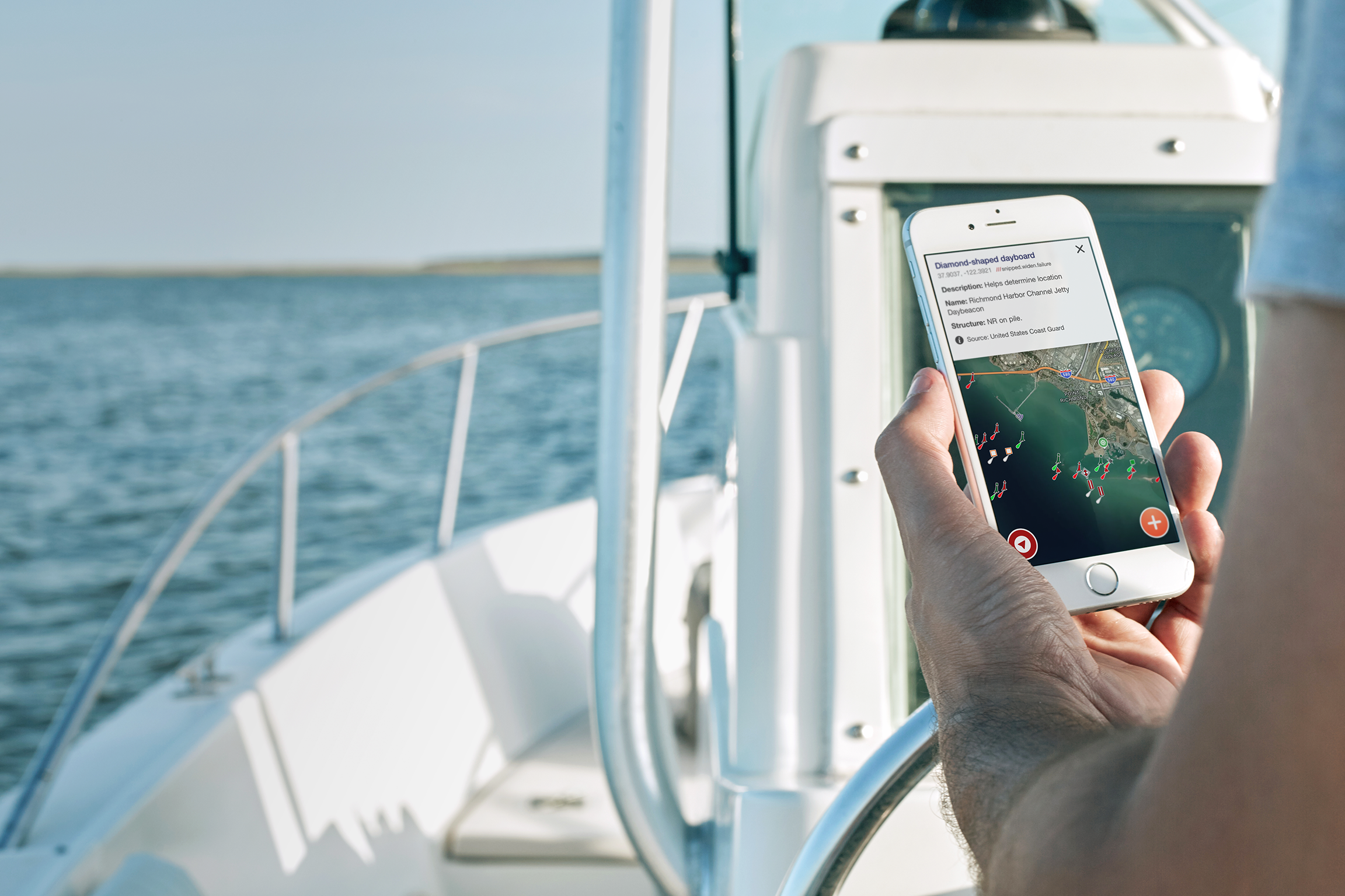
Location information
Selecting a particular location on Google Maps brings up its information profile, which is formed from different web and user-generated sources. It generally includes photos, reviews, information links and nearby places.
Navigation tools
Google Maps allows users to download sections of the map for use offline, making it easier to reference and search that area even when phone reception is not available. However, functionality is limited and does not have up-to-the-minute information on conditions and weather.
While you can create a personalised map and custom settings, Google Maps doesn't provide built-in directions for boat routes. For a clearer picture of the boating location, many navigators and boaters turn to alternate solutions.
The Deckee app provides boaters with a number of tools to stay safe and informed on the lake.

HOW TO USE THE DECKEE APP
Points of interest
Users can use the app to locate points of interest such as anchorages, marinas and facilities along the shore of a lake. Where Deckee differs from most apps is it has a detailed map of public mooring locations, boat ramps, speed zones and aids to navigation provided by official marine authorities like the U.S. Coast Guard.
Points of interest can be added, updated and notes made by the boating community to share their local knowledge.
Satellite imagery
The satellite mapping provides clear and crisp imagery of lakes and rivers, including fishing spots and other points on the water. The satellite maps are constantly updated and refreshed worldwide to deliver incredible coverage for boaters.
The image quality in conjunction with image volume, and recency creates an interactive map experience, where users can zoom in to explore reefs, coastal bars and islands.
Deckee Trips
Deckee has also introduced a trip feature, which allows users to log, save and share their journeys. It aims to improve users' awareness and assist with navigation to make sure everyone gets home safely.
Measuring speed (kn), distance (nm) and heading in real-time, trips also records your total trip for future reference and shows total distance and trip time, average speed, as well as the start and finish times.
Weather warnings
To help boaters correctly judge conditions and receive potentially life-saving warnings even if they are out on the water, the app provides official maritime data and alerts from state authorities in NSW, Western Australia and Tasmania.
One of its big advantages is utilising weather data sourced from official government agencies like the Bureau of Meteorology, and users have the ability to receive crucial weather warnings in real-time.
Active warnings appear in the weather panel of any chosen location, direct from the local weather station. Timely push notifications can be sent directly to a user's device from a current position or home location within a warning area.
Deckee is continually improving and adding features, with the goal to encourage boaters from all walks of life out and enjoying the water as safely as possible. Deckee has tools that will be more useful on the water than Google Maps, and there’s no need to be an expert in navigation to use the app.
Download the Deckee boating app for free, and use it on your next trip.